
RIEGL LIS ALS Classification Plugin
This plugin provides methods to classify airborne LiDAR collections to ground, building, and low/medium/high vegetation

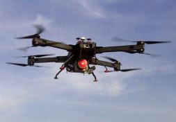
RIEGL BathyCopter
World's first Small-UAV-Based Surveying System for Hydrographic Applications
RiCOPTER with VUX-SYS
The RIEGL VUX-SYS is a complete miniaturized airborne laser scanning system solution of low weight and compact size for flexible use in UAS/UAV/RPAS, helicopter, gyrocopter and ultra-light ...

POSPac MMS 8
Optimized for all environments and platforms (air, land, and marine) and compatible with a variety of mapping sensors, this smart software solution achieves both maximum accuracy and ...

PointCab Origins
PointCab Origins is the evaluation of point cloud data – working with all laser scanners and compatible with all CAD and BIM systems

Orbit 3DM Content Manager
organize & manage, catalog & archive improve & optimize image and point cloud data QA/QC, document and report independent deliver ready-made projects after capture upload to share online

microTABI-640
Portable air/ground broadband pushbroom thermal (MWIR) featuring a small form factor (~2 kg), wide imaging array, and high thermal resolution.

MicroSurvey STAR*NET V8
32-bit Windows package that adjusts 2D/3D survey networks using rigorous Least Squares techniques.
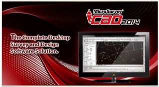
MicroSurvey CAD2014
MicroSurvey CAD is a Complete Desktop Survey and Design Program Created for Surveyors, Contractors and Engineers
microSASI-384
Portable air/ground hyperspectral pushbroom SWIR featuring a small form factor (~2 kg).
microCASI-1920
Portable air/ground hyperspectral pushbroom VNIR featuring a small form factor (<1.5 kg), 288 programmable channels, and wide imaging array.

Mesa Rugged Notepad
WORLD’S FIRST RUGGED NOTEPAD Meet the Mesa Rugged Notepad™— featuring the advantages of both a tablet PC and a rugged handheld computer, without the disadvantages of either.

Mesa 2 Rugged Tablet
YOUR OFFICE, ANYWHERE Introducing… your new office. In a sleek package with the highest-rated protection against water and dust, the Mesa 2 Rugged Tablet can go with you into the ...

MASI-600
The MASI-600 is the first commercially available Midwave hyperspectral sensor designed specifically for airborne use. As with all of our sensors, the MASI-600 has custom designed optics ...

LFM NetView
LFM NetView provides secure access to remote 3D laser scan data. More than an online viewing package, it provides tools that allow users to work collaboratively with laser scan data over ...

LFM Modeller
Produce 3D CAD models from as-built laser scan data. Model pipes and structural standards from the standards library using BubbleView™ Modelling. Export intelligent 3D models into a range ...
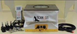
Level-Plane Evo 14
Platform for automatic biaxial leveling with accuracy +/-3”, for 3D Laser Scanner surveys or robotic Total Station
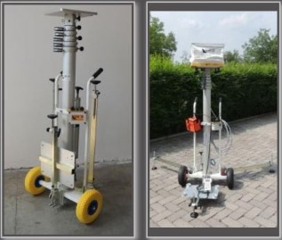
Kangur-Lift System
System for lifting of the Level-Plane Evo 14, composed of a telescopic column with pneumatic extension by hand pump.
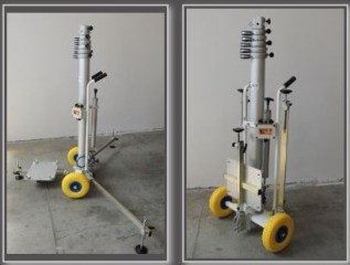
Kangur-Lift
System for the lifting of 3D Laser Scanner, composed of a telescopic column with pneumatic extension by hand pump.

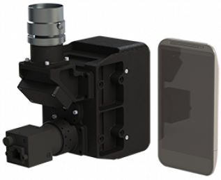
iXM-100/ iXM-50 UAV and Drone Cameras
A Revolution in UAV and Drone Cameras Phase One Industrial developed the iXM series – revolutionary and uniquely designed cameras for UAV-based aerial imagery that redefine the boundaries ...