

MicroSurvey STAR*NET V8
32-bit Windows package that adjusts 2D/3D survey networks using rigorous Least Squares techniques.
MicroSurvey CAD2014
MicroSurvey CAD is a Complete Desktop Survey and Design Program Created for Surveyors, Contractors and Engineers

RIEGL VZ-4000
Offers superior and unrivaled long range measurement performance of up to 4000 m reflectorlessly (Laser Class 1).

LFM Modeller
Produce 3D CAD models from as-built laser scan data. Model pipes and structural standards from the standards library using BubbleView™ Modelling. Export intelligent 3D models into a range ...

LFM NetView
LFM NetView provides secure access to remote 3D laser scan data. More than an online viewing package, it provides tools that allow users to work collaboratively with laser scan data over ...
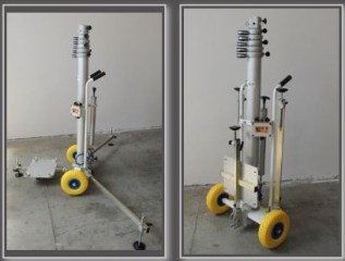
Kangur-Lift
System for the lifting of 3D Laser Scanner, composed of a telescopic column with pneumatic extension by hand pump.
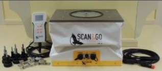
Level-Plane Evo 14
Platform for automatic biaxial leveling with accuracy +/-3”, for 3D Laser Scanner surveys or robotic Total Station
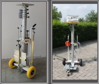
Kangur-Lift System
System for lifting of the Level-Plane Evo 14, composed of a telescopic column with pneumatic extension by hand pump.

RIEGL VMZ
The new, fully integrated, accurate, and compact RIEGL VMZ Hybrid Mobile Laser Mapping System enables combined static and kinematic data acquisition using a single RIEGL VZ-400, VZ-1000 or ...

Mesa 2 Rugged Tablet
YOUR OFFICE, ANYWHERE Introducing… your new office. In a sleek package with the highest-rated protection against water and dust, the Mesa 2 Rugged Tablet can go with you into the ...

Allegro 2
DESIGNED FOR THE DATA-INTENSIVE From the carefully selected, textured buttons which click with just the right amount of feedback, to the slope of the contours that mimic so perfectly the ...

Archer 2
WHEREVER YOUR JOB TAKES YOU From the hammer and anvil, the Archer 2 has emerged faster, smarter, and more sophisticated than ever before, claiming top spot among the most advanced rugged ...

Mesa Rugged Notepad
WORLD’S FIRST RUGGED NOTEPAD Meet the Mesa Rugged Notepad™— featuring the advantages of both a tablet PC and a rugged handheld computer, without the disadvantages of either.

Geode
REAL-TIME SUB-METER GPS RECEIVER Looking for a simple sub-meter GNSS solution at an affordable price? With the Geode, you can easily collect real-time, sub-meter GNSS data without the ...

CT7
CT7 7-INCH RUGGED ANDROID TABLET Combining the power and versatility of Android with extra ruggedness, the CT7 provides a large, 7-inch display to easily view and collect your data.

CT4
CT4 RUGGED ANDROID HANDHELD The CT4 rugged handheld provides ruggedness and functionality in a lightweight, compact package. Featuring 3.5G GSM cellular, Wi-Fi, Bluetooth, GPS, and an 8 ...

CMP1 Miniphone
CMP1 Miniphone Smaller than the palm of your hand, this tiny, but mighty Android miniphone packs all your smartphone capabilities into a convenient, travel-sized device. Rated IP65, the ...
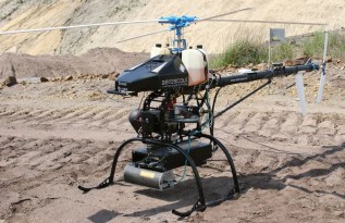
Aeroscout Scout B1-100
Aeroscout provides autonomously flying, industrial unmanned helicopters for aerial imagery and photogrammetry, aerial video recording, surveillance and inspection, 3D laser mapping, search ...

TSR-1800
The TSR-1800’s automated thermal anomaly detection is made possible by the TABI imager’s high temperature and spatial resolution capabilities. Flying low (~500 m or 1627 feet above ground ...

CASI-1500h
The CASI-1500 is a visible near Infrared (VNIR) sensor which offers an impressive 1500 pixels across its field of view, allowing you to image a vast area with a single pass, or achieve ...