GeoSLAM


GeoSLAM ZEB Locate
Connect your point cloud to the real world, without the need for external control points
Base price:


GeoSLAM HUB
The dependable lightweight, handheld scanner, take it with you wherever you go.
Base price:
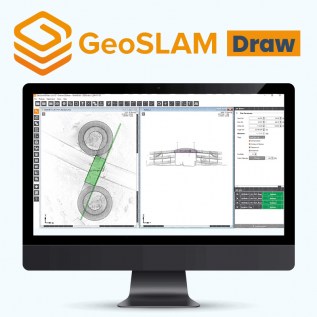
GeoSLAM Draw
GeoSLAM Draw creates 2D plans, sections and elevations from 3D pointcloud data in minutes
Base price:

GeoSLAM Connect
GeoSLAM Connect is a powerful 3D Process Automation solution for processing and managing data generated by the ZEB-series of handheld laser scanners.
Base price: