Software & Custom Apps
PointCab Origins
PointCab Origins is the evaluation of point cloud data – working with all laser scanners and compatible with all CAD and BIM systems
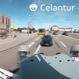
Celantur Automated Image Blurring Solution
Automatically anonymize faces, bodies and license plates to comply with the GDPR, CCPA, PIPEDA, etc.
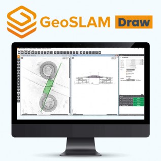
GeoSLAM Draw
GeoSLAM Draw creates 2D plans, sections and elevations from 3D pointcloud data in minutes

GeoSLAM Connect
GeoSLAM Connect is a powerful 3D Process Automation solution for processing and managing data generated by the ZEB-series of handheld laser scanners.

3DM PLUGIN FOR 3RD PARTY
QGIS, AutoCAD Map, ArcGIS for Desktop, ArcONLINE, GeoCortex, API access published 3D mapping data within 3rd party workflow measure, overlay and extract from Imagery & Point Cloud

Orbit 3DM Content Manager
organize & manage, catalog & archive improve & optimize image and point cloud data QA/QC, document and report independent deliver ready-made projects after capture upload to share online

3DM FEATURE EXTRACTION
Complete mapping unit for Image, LiDAR and DSM mapping process features and results in semi- or full automated mode document assets, centralize data management roles and permissions for ...
