Software

RIEGL RiACQUIRE
RiACQUIRE covers a wide variety of tasks present in RIEGL's mobile and airborne laser scanning systems. Both, mobile and airborne systems comprise at least one laser scanner, a position and ...

PointCab Origins
PointCab Origins is the evaluation of point cloud data – working with all laser scanners and compatible with all CAD and BIM systems
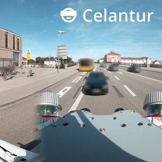
Celantur Automated Image Blurring Solution
Automatically anonymize faces, bodies and license plates to comply with the GDPR, CCPA, PIPEDA, etc.

GeoSLAM Connect
GeoSLAM Connect is a powerful 3D Process Automation solution for processing and managing data generated by the ZEB-series of handheld laser scanners.

Global Mapper
Global Mapper is all in 1 GIS software. Global Mapper is an affordable and easy-to-use GIS application that offers access to an unparalleled variety of spatial datasets and provides ...

Global Mapper LiDAR Module
At a fraction of the cost of comparable applications, the Global Mapper LiDAR Module is a must-have for anyone using or managing terrestrial or airborne LiDAR as well as other point cloud ...

GeoSLAM HUB
The dependable lightweight, handheld scanner, take it with you wherever you go.

3DM PLUGIN FOR 3RD PARTY
QGIS, AutoCAD Map, ArcGIS for Desktop, ArcONLINE, GeoCortex, API access published 3D mapping data within 3rd party workflow measure, overlay and extract from Imagery & Point Cloud


3DM FEATURE EXTRACTION
Complete mapping unit for Image, LiDAR and DSM mapping process features and results in semi- or full automated mode document assets, centralize data management roles and permissions for ...

Orbit 3DM Content Manager
organize & manage, catalog & archive improve & optimize image and point cloud data QA/QC, document and report independent deliver ready-made projects after capture upload to share online

AVEVA LFM Server
Import 3D scan data and interface with all major 3D CAD packages. Different Modes. One unified work process.

Bentley Pointools
Quickly visualize, manipulate, animate, and edit point clouds all in a single workflow. This streamlined process helps you decrease production time and increase overall accuracy.


Bentley Descartes
Bentley Descartes is an information modeling software product and an extension of MicroStation, for visualization, vector-to-raster, raster-to-vector conversion, and the management and ...

Bentley MicroStation
MicroStation is the world’s leading information modeling environment explicitly for the architecture, engineering, construction, and operation of all infrastructure types including utility ...

ContextCapture
With ContextCapture, you can produce even the largest and most challenging 3D models of existing real-world conditions, including scales as large as entire cities, from simple photographs, ...

LFM NetView
LFM NetView provides secure access to remote 3D laser scan data. More than an online viewing package, it provides tools that allow users to work collaboratively with laser scan data over ...

LFM Modeller
Produce 3D CAD models from as-built laser scan data. Model pipes and structural standards from the standards library using BubbleView™ Modelling. Export intelligent 3D models into a range ...
MicroSurvey CAD2014
MicroSurvey CAD is a Complete Desktop Survey and Design Program Created for Surveyors, Contractors and Engineers